Record-breaking rain lashes California, with 2 people killed during storm in Sonoma County
Published in Weather News
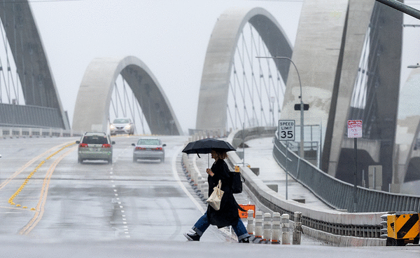
LOS ANGELES — The second of back-to-back atmospheric rivers, which unleashed heavy rain across Northern California this week killing two people, was set to dampen Southern California through Friday morning.
And a potentially more powerful system could douse Southern California before or around Valentine’s Day, heightening concerns for recently burned communities in Los Angeles County.
There is now a 20% chance that there could be high amounts of rain between Feb. 12 and Feb. 15, according to Ryan Kittell, a meteorologist with the National Weather Service’s Oxnard office. That’s up from a 10% chance that was forecast a day earlier.
“It’s not a slam dunk that Southern California is going to be wet, but the odds are much more favorable — increasing especially the past day or so — that we will have a significant atmospheric river in California, and that significant rainfall could make it into Southern California,” said Alex Tardy, a meteorologist with the National Weather Service’s San Diego office.
High amounts of rain would mean 2 to 4 inches or more on the coast and in the valleys, and 4 to 8 inches or more in the mountains and foothills of Los Angeles, Ventura, Santa Barbara and San Luis Obispo counties.
The forecast remains murky, though. There’s a 50% chance of moderate amounts of rain. There is also a chance of low rain or no rain at all.
If it does arrive, the storm would probably be an atmospheric river.
Atmospheric river storms are long plumes of water vapor that can pour over from the Pacific Ocean into California. They carry so much water that they’re said to be like a river in the sky. Just a few atmospheric river events can bring California from one-third to one-half of its annual precipitation.
“The message is that there is a growing potential for higher totals and higher impacts,” Kittell said. A super-soaker storm is “still not the most likely outcome, but enough to really keep an eye on.”
This week’s rain comes amid one of the driest starts to the water year in Southern California in modern history. The bone-dry brush, low humidity and Santa Ana winds in January created a devastating combination that fueled massive firestorms in Los Angeles County.
The moisture was a welcome reprieve from fire weather, but officials are also concerned that too much rain too fast might trigger debris flows in the Eaton and Palisades burn scars.
So far, that situation has not come to pass.
The first atmospheric river that arrived in Southern California earlier this week had packed a wallop in Northern California, but weakened significantly as it moved down the state.
The storm brought modest rainfall amounts to Ventura, Los Angeles, Orange and San Diego counties.
Less than a quarter of an inch of rain had fallen along the Los Angeles coast and the San Fernando and San Gabriel valleys as of Thursday morning. Santa Barbara County saw slightly higher rain totals with just under an inch falling in the Refugio Pass, according to the weather service.
Over a 12-hour period ending at 8 a.m. Thursday, Beverly Hills saw 0.22 of an inch of rain; downtown Los Angeles, 0.05 of an inch; Los Angeles International Airport, 0.08 of an inch; La Canada Flintridge, 0.18 of an inch; East Pasadena, 0.18 of an inch and Monte Nido, 0.36 of an inch.
Storm No. 1 exited Los Angeles County on Wednesday, while Storm No. 2 is expected to arrive in Southern California on Thursday afternoon and last through Friday.
Forecasters predict the second storm will be of similar strength, dropping between a quarter of an inch and an inch of rain across the region through Friday morning. The mountains and foothills could see a bit more moisture—between an inch and two inches of rain, according to the weather service.
“This is the type of storm that we really want in general — light, steady rain, not all coming down at once,” Kittell said. Minor road flooding and falling rocks on canyon roads are possible.
There’s a 5% chance of thunderstorms. Rainfall rates are expected to be between one-tenth of an inch per hour and a quarter of an inch per hour, though there could be stronger isolated periods of rainfall.
There’s a very low risk — less than 5% — of rain falling so hard that debris flow and mudslides would be triggered in recent burn areas, according to Kittell. If significant debris flow does happen, it would be the result of a stray intense storm cell materializing directly over a burn scar.
In Northern California, the storm broke daily rainfall records in San Francisco, San Mateo County and Sonoma County, causing flooding of the Russian River in Guerneville, and near Hopland, in Mendocino County.
Two people died in Sonoma County in less than 24 hours during the storm. Both bodies were pulled from flood waters, according to the Sonoma County Sheriff’s Office.
On Wednesday evening, the body of a man was pulled from a culvert on Franz Valley Road in Santa Rosa. Early Thursday, the body of another man was recovered from flood waters along Hall Road in Santa Rosa. The individuals have not been identified, according to the sheriff.
Earlier in the week, a house in Forestville slid into the Russian River after a rain-saturated hillside gave way, and floodwaters temporarily closed lanes of U.S. 101, Interstate 5 and California 99 across the region.
Whether next week’s storm could have a similar effect in Southern California is unclear. The duration is still hazy, but it’s appearing at this point to be a longer duration event, meaning the rain would fall over a 24-hour period or longer, said Kristan Lund, a meteorologist with the National Weather Service in Oxnard.
And it’s still too early to tell how intense the rain might be — a key factor in determining the threat of debris flows and mudslides in recent burn areas. Meteorologists say the risk of significant debris and mud flows starts when rain falls at a rate of half an inch per hour.
“We’re not quite confident that we will get the brunt of it here in SoCal. We might just get portions of it,” Tardy said, “but it could be a wetter storm than what we’re seeing Thursday night and Friday of this week.”
After the rain tapers off Friday night, wind is expected to once again kick up across Southern California. But the fire weather risk will be minimal, given recent rains.
Los Angeles and Ventura counties could see wind gusts from the southeast and southwest, peaking between 6 p.m. Thursday and Friday at 8 a.m. Gusts could reach 30 mph to 40 mph in San Luis Obispo County, northern Santa Barbara County and L.A. County’s high desert, but are expected to be milder in the Los Angeles metro area and most of Ventura County, with gusts around 10 mph.
At LAX, winds could come out of the east, Kittell said. They won’t be particularly strong, but they may be strong enough to change flight operations, prompting delays.
“This is not a true Santa Ana. It’s more of a northerly type wind event, and it’s dry, but not terribly dry,” Kittell said. “The recent rains are sufficient enough to dampen [and] limit any fire weather concerns, at least for this next push.”
From Friday night through Monday, gusts could reach 12 mph in Covina; 14 mph in downtown Los Angeles and Long Beach; 21 mph in Canoga Park, Thousand Oaks and Fillmore; 22 mph in Oxnard; 26 mph in Santa Clarita; 28 mph in Acton; 41 mph in Lancaster and 58 mph at Pyramid Lake.
Although the recent moisture will help reduce wildfire risk across Los Angeles and Ventura counties, it probably won’t be enough to definitively end fire season given the region’s severe winter rainfall deficit.
Downtown L.A. has received just 0.7 of an inch of rain since the water year began Oct. 1; the average for this time of year — a little more than four months into the water year — is 7.68 inches. The annual average is 14.25 inches.
Downtown’s driest water year on record ended Sept. 30, 2007, when only 3.73 inches of rain fell. The following summer and fall were a bad fire season — with the largest blazes being the Zaca fire that burned more than 240,000 acres in Santa Barbara County and the Witch fire in San Diego County, which burned nearly 198,000 acres, destroyed 1,650 structures and killed two people.
“If we get a long dry period — for a week or two or three — following the rain [this week], then we might be back into that fire weather danger,” Kittell said, especially if Santa Ana winds return. Severe Santa Ana winds are most common between October and March, though they can occur as late as May.
©2025 Los Angeles Times. Visit at latimes.com. Distributed by Tribune Content Agency, LLC.


Comments