Winter Storm Fern's snow turns to sleet and ice across KY. Here's what to expect
Published in News & Features
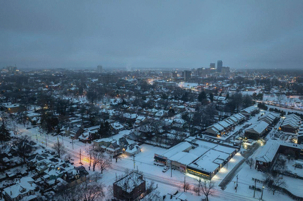
Winter Storm Fern entered its second day Sunday, bringing more ice, snow and confirmed power outages across Kentucky.
Much of what the state can expect as far as accumulation Jan. 25 will fall as sleet, though there may be a brief period of snow this afternoon, according to the latest forecast from the National Weather Service.
This situation is especially dangerous, forecasters warn, as Sunday’s precipitation adds an additional slick layer to ice and snow that blanketed Central Kentucky Saturday and overnight, solidified by frigid temperatures.
“Kentucky is in the heart of the storm right now as precipitation moves across the state, and ice has become our biggest concern,” Gov. Andy Beshear said Sunday. “We expect snow, sleet and ice to keep falling throughout today and overnight. This is combined with dangerously cold temperatures throughout next week.”
The weather service expects ice totals in Central Kentucky are around a quarter-inch to a half-inch. Sunday’s high temperature in Lexington is forecast at 27 degrees, with an overnight low around 5 degrees and wind chill of negative 4.
Ice accumulations are higher than expected, becoming the main safety concern Sunday, according to Beshear. Bowling Green to Campbellsville, Richmond, Morehead and Ashland could see up to a quarter inch of ice.
“Additional snow and sleet accumulations up to 7 inches are expected across southern Indiana and north central Kentucky. The higher of these values are expected across parts of southern Indiana, where less sleet is expected,” the NWS said in a Sunday morning winter storm warning update. “Along and southeast of the Western Kentucky and Bluegrass Parkways, ice accumulations from a glaze to half of an inch is expected.”
The winter storm warning is in effect until 7 a.m. Monday, Jan. 26 for much of the state, and a cold weather advisory was issued for midnight Sunday night until 11 a.m. Tuesday, Jan. 27, when wind chills could be as low as 15 below zero, the NWS said.
Temperatures will remain frigid through the rest of the week. Lexington’s high is not expected to reach above the low 20s at least through next Saturday, Jan. 31, and lows most days will be in the single or even negative digits.
Power outages from ice expected to climb
The increase in ice overnight has already made roads hazardous and caused some power outages statewide, with more than 69,000 Kentucky customers without power as of 1:22 p.m. Sunday.
Pulaski County has the highest recorded number of outages at 10,498, according to PowerOutage.us. As of Sunday afternoon, many of the outages were located in the south and south-eastern regions of the state.
An extreme cold warning was issued Sunday and is expected to last through Tuesday, according to WKYT chief meteorologist Chris Bailey. Lows can drop as low as negative 10, with wind chills dropping 20 below at times. “With tens of thousands of people without power, this is a life-threatening situation,” Bailey said.
The governor said the number of power outages is expected to rise throughout the day, making warming centers even more critical. Kentucky currently has 113 such enters set up across the commonwealth.
Beshear and Lexington Mayor Linda Gorton have declared states of emergency ahead of the storm. Lexington’s emergency operations center opened at 8 a.m. Saturday, the city said in a news release.
President Donald Trump approved an emergency disaster declaration for the winter storm, unlocking federal aid to Kentucky and several other states, Gov. Andy Beshear said in a post on social media platform X Saturday evening.
©2026 Lexington Herald-Leader. Visit at kentucky.com. Distributed by Tribune Content Agency, LLC.


Comments